Welcome to Pemberton, British Columbia
Discover the stunning natural beauty and endless adventures that await you in Pemberton. Nestled in the heart of British Columbia, our vibrant community offers an unforgettable experience for every visitor.
Where is Pemberton?
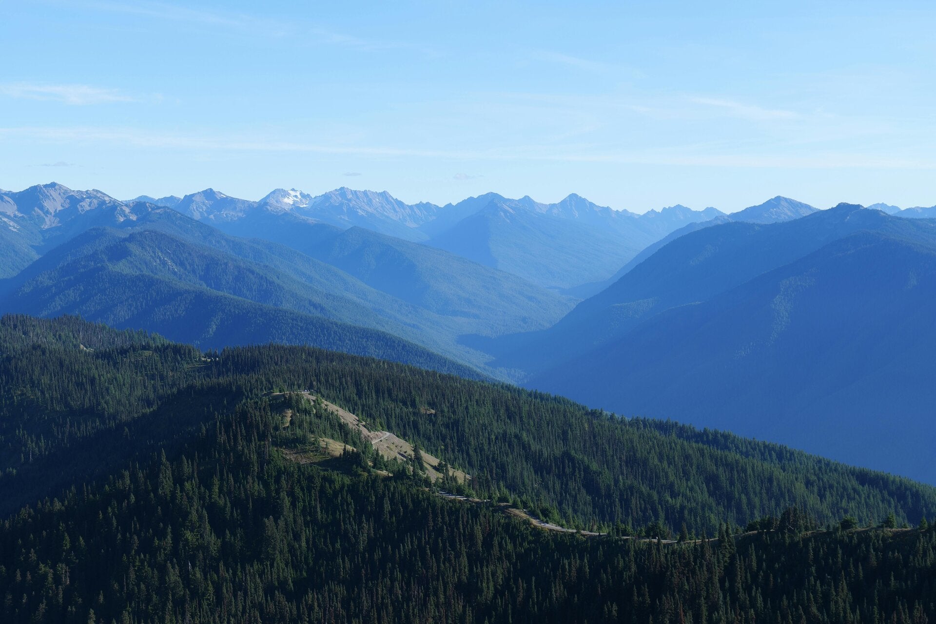
Pemberton is located in the Squamish-Lillooet district immediately north of Whistler and is dominated by striking views of Mt. Currie (Ts'zil). Pemberton is know for its giant peaks, evergreen forests and its chill presence in the coast Mountains.

Geology of Pemberton
Pemberton, British Columbia, is located within the Coast Mountains along the active western flank of BC, where tectonic activities are dominated by the long-term subduction of the Juan De Fuca plate beneath the North American Plate. This subduction has produced volcanic peaks and uplifted terrain, including the nearby Mount Meager volcanic complex, and part of the Pemberton Volcanic Belt, which is one of the most geothermally active areas in Canada. The geology of the Pemberton Valley shows this volcanic influence as well as significant sedimentary processes. Past eruptions from Mount Meager, last one occuring about 2,350 years ago, generated volcanic deposits that temporarily congested the Lillooet River, forming a lake that later catastrophically drained, sending large boulders and reshaping the valley landscape. Today, the valley floor is composed largely of fertile soils and glacial sediments, with acidic soils coming from volcanic activity, as well as clastic materials that continue to be changed by river systems and slope processes such as landslides and debris flows.
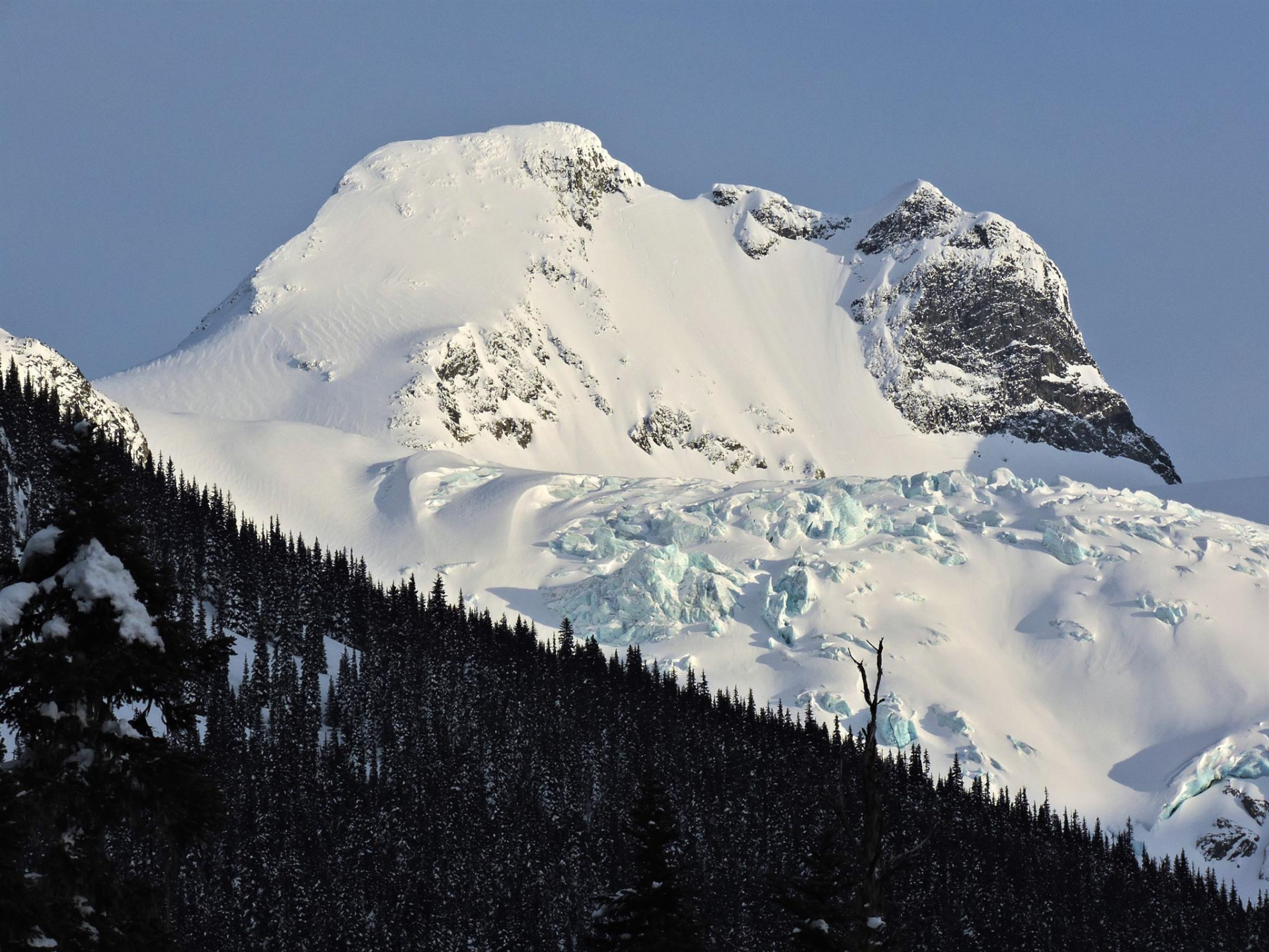
Glaciation has played a very dominant role in shaping the region’s landscape, particularly during the Pleistocene epoch when large ice sheets carved out the characteristic U-shaped valleys, steep valley walls, and cirques seen today. Today's glaciers and ice fields in the surrounding mountains continue to influence the hydrology by sending meltwater and sediment to river systems. Pemberton lies within a rugged, high-relief mountain environment which is regular of the Coast Mountains, where steep, icy peaks surround a big, flat bottomed valley that was created by glacial activity. This valley functions as a part of the Lillooet River watershed, with the Lillooet River being the primary drainage channel, flowing south into Lillooet Lake. Major tributaries like the Green, Birkenhead, and Ryan Rivers greatly contribute water from surrounding mountainous watersheds, fed by glacial melt, snowmelt, and heavy coastal precipitation. The Pemberton watersheds carry high sediment loads and are fairly prone to flooding, channel migration, reflecting the ongoing interactions between tectonic activity, past volcanism , glacial action, and river dynamics that continue to shape the Pemberton landscape.

Temperature and precipitation
Pemberton, British Columbia falls within a temperate mountain climatic zone greatly influenced by the coastal Pacific air masses and its inland position within the Coast Range, resulting in bigger seasonal temperature variation than nearby coastal regions. Climatic normals show that average temperatures range from around −5°C in January, the coldest month, to approximately 25–27°C in July, the warmest month, implying fairly warm summers and cold winters which is expected of an interior valley location. Precipitation also follows a strong seasonal pattern, with annual totals highest in the fall and winter months, particularly in November, when frequent Pacific storm systems bring heavy rainfall. In contrast, summer months such as July and August are relatively dry, creating a distinct wet–dry seasonal cycle.
During winter, a significant portion of precipitation falls as snow, contributing to snowpack in surrounding mountains and feeding spring and summer meltwater. These climatic normals reflect Pemberton’s position in a transition zone in between the coastal maritime climate and the continental climates of the interior, where orographic uplift rises over the Coast Mountains and enhances the precipitation, while the valley location allows for warmer summer temperatures and colder winter conditions compared to the coast of BC.
The Bioregion & Ecoprovince of Pemberton
Pemberton, British Columbia lies in the Coast Mountains Eco-province, a region known for its rugged, glaciated terrain, high amounts of precipitation, and diverse ecosystems shaped by strong elevational gradients. Within this eco-province, the general ecosystem is dominated by coniferous forest communities, particularly at lower and mid-elevations, where species such as western hemlock, Douglas fir, and western red cedar are common. As elevation increases, forests transition into subalpine and high alpine zones with mountain hemlock, amabilis fir, and eventually alpine tundra vegetation consisting of grasses, mosses, and shrubs. The vegetation zones here reflect variations in temperature, moisture, and soil conditions across the landscape.
The fauna of the region is just as diverse, showing the range of habitats present. Large animals such as black bears, grizzly bears, mountain goats, and deer are common of the mountainous terrain, while smaller mammals and numerous bird species inhabit forested and vegetated areas. Rivers and wetlands support fish populations, including salmon and trout, which are vital to ecosystem functioning. Overall, the ecosystem of the Pemberton area is defined by the interaction of climate, topography, and vegetation, with its classification within the Coast and Mountains Ecoprovince highlighting a complex, highly productive environment that supports a wide variety of plant and animal life.

Indigenous History In Pemberton, BC
Pemberton lies within the traditional territory of the Lil’wat Nation, whose connection to the land extends back thousands of years and remains central to their identity today. The Lil’wat people, part of the larger St’át’imc Nation, have traditionally relied on the nearby mountains, rivers, and forests to sustain themselves, using seasonal rounds to harvest salmon, hunt wildlife, and gather plant resources for food, medicine, and tools.
Their language, Ucwalmícwts, reflects a close and very deep relationship with the land, with place names and knowledge systems tied directly to the environment. The territory has also been shaped by historical conflicts and the need to defend and maintain access to key resource areas, reinforcing strong governance systems and cultural continuity. Today, the Lil’wat Nation continues to actively manage and protect their lands through cultural revitalization, language preservation, and land stewardship initiatives, including participation in environmental monitoring, sustainable resource management, and economic development projects that align with their values. This current and ongoing relationship demonstrates both cultural continuity and adaptation, as traditional knowledge and practices are still integrated in community life and decision making.

Settler history In Pemberton.
Pemberton’s settler history shows how the town gradually grew and adapted over time rather than developing all at once. In the mid-1800s, the area first drew people in during the Fraser River gold rush, as it sat along travel routes to the goldfields. While many were just passing through, some recognized the valley’s rich, fertile soil and decided to stay, beginning small farming operations. Agriculture quickly became the main reason the town formed, especially with crops like potatoes, which thrived in the local conditions and helped establish Pemberton as a farming community.
For a long time, however, Pemberton remained quite isolated. Early access was limited to trails and pack routes, making travel and trade challenging. It wasn't until 1914 when the railway arrived, later followed by electricity and better improved road access in the mid 20th century, that the community became more stable and connected. These changes made it easier for people to work and live in the Pemberton area, helping the town persist despite its remote location.
Over many years, Pemberton’s role has shifted. While agriculture is still an important part of the community, the town is no longer defined by farming alone. Its scenic setting and proximity to outdoor recreation have made it increasingly attractive for tourism and as a place to live. Today, Pemberton shows a mix of its agricultural history and more recent economic opportunities, showing how it has been able to adapt and remain relevant over time rather than fading like some other rural towns and settlements.

Resource extraction
Mining and Forestry have both shaped the Pemberton area in different ways over time. Mining hasn't been very prominent anymore but forestry still plays an important role, but in a more efficient and sustainable way, with places like the Speĺkúmtn Community Forest focusing on protecting the environment while still providing resources for the community. During the Fraser Canyon Gold Rush in the mid-1800s, prospectors passed through the area looking for gold, which increased the need for routes, supplies, and materials. This led to early logging, as trees were cut down to build boats, bridges, and basic infrastructure. As more settlers arrived, forestry became part of everyday life, with people clearing land for farming and using wood to build homes and barns. By the early 1900s, logging had grown into a major industry, especially after the railway reached Pemberton in 1914 and made it easier to transport timber and other goods. Mining eventually faded as gold became harder to find, forestry continued to support the local economy.

Economic activity
Pemberton’s economy has changed significantly over time, changing from a small, resource based community to one that is now largely driven by tourism and services. In the past, agriculture and forestry were the powerhouse of the local economy, with numerous farms down in the Pemberton Valley and logging operations helping sawmills and other basic manufacturing. These industries provided most of the jobs and shaped daily life for many residents. Over time, though, this began to change. As forestry declined and nearby Whistler grew into a major tourist destination, Pemberton started to benefit from increased visitor traffic and new economic opportunities. Today, tourism plays a much bigger role, supporting local businesses like restaurants, shops, accommodations, and outdoor recreation services. The service sector has grown alongside this, becoming the main source of employment in the area. Even though farming and forestry are still part of Pemberton's economy, they are no longer the big industries they once were and now play more of a supporting role. Overall, Pemberton reflects a broader shift toward a more diverse, service-based economy that still tries to balance growth with its natural wonders and rural background.

Pemberton Elected officials
- Shift toward more progressive federal politics: The region where Pemberton is located is currently represented by Patrick Weiler from theLiberal Party of Canada, reflecting a move since around 2019 away from earlier Conservative representation toward more centre-left priorities like climate action and reconciliation.
- Practical, non-partisan local governance: Village of Pemberton Council operates without any party association focusing on basic issues such as housing, infrastructure, and land use (generally resulting in moderately progressive, community oriented decision-making rather than ideology politics.)
- Strong Indigenous Influence in Governance: The Lil'wat Nation plays an important role in the region with a governance model centreed on Indigenous rights, land stewardship, and community well being, shaping the broader political culture beyond a regular left/right framework.

Mike Richman
Mayor

Patrick Weiler
Local MP

Dean Nelson
Li'lwat Chief
Local Issues
Pemberton, BC, is quickly changing, and with that growth comes a mix of opportunities and some challenges. Pemberton was known as a quiet, and fairly affordable town with low taxes and limited infrastructure. Today, however, the village is feeling the growing pains of the increasing population. To keep up, the town needs to invest in things like water systems, emergency services, and other infrastructure, which is leading to noticeable tax increases. At the same time, housing prices have risen as more people look to Pemberton as an alternative to nearby Whistler, making it harder for locals especially workers to afford to live there. This has had a ripple effect, particularly on healthcare, where the community struggles to attract and keep doctors. On top of that, as the population grows, so does the need for policing, which adds even more to municipal costs. Altogether, Pemberton is facing the challenge of balancing growth with affordability, quality of life with challenges like rising taxes, housing pressures, limited medical services, and increasing costs all become a big part of everyday life for residents.

Local Amenities
Pemberton, BC is a small mountain town just north of Whistler that offers a quiet, outdoors focused lifestyle with a strong sense of community. It doesn’t have the kind of urban amenities you’d find in a city there are no real malls, large hospitals, and just one Rec centre, however it still has the basics, like a community centre, a small and chill gym, a local skate park, a library, and a couple of shops, cafés, and other services along its main street. For more significant facilities like swimming centres or advanced medical care, people typically head to Whistler as it is very close. What really defines Pemberton, though, is its access to nature. The area is known for incredible hiking, with places like Joffre Lakes and Nairn Falls nearby, as well as mountain biking, fishing, horseback riding, and backcountry adventures. In winter, residents and visitors can easily access Whistler Blackcomb for skiing or explore local terrain for snowmobiling and ski touring. The food scene leans heavily into its agricultural roots, with local farms, fresh produce, and a growing craft beer presence rather than wineries. Despite Whistler being a different town, Pemberton provides a nice relaxed base to access the ski resort and other whistler activities. Accommodation spans from motels to lodges, and cabins. Overall, Pemberton is less about built amenities and more about lifestyle which is optimal for people who value peace, nature, and year-round outdoor activity over city life and convenience.

Information
Bibliography
Government of BC. (2008). Sea to Sky land and resource management plan. https://www2.gov.bc.ca/assets/gov/farming-natural-resources-and-industry/natural-resource-use/land-water-use/crown-land/land-use-plans-and-objectives/southcoast-region/seatosky-lrmp/plan/seatosky_lrmp_plan_apr2008.pdf
Government of BC. (n.d.). An introduction to the ecoregions of British Columbia. https://www2.gov.bc.ca/assets/gov/environment/plants-animals-and-ecosystems/ecosystems/broad-ecosystem/an_introduction_to_the_ecoregions_of_british_columbia.pdf
Government of BC. (2020). Province supports agriculture in Pemberton. https://news.gov.bc.ca/releases/2020AGRI0040-001264
Government of BC. (2026). News release. https://news.gov.bc.ca/releases/2026WLRS0016-000280
Lil’wat Nation. (2020). Lil’wat Nation fact book. https://fngovernance.org/wp-content/uploads/2020/06/Lilwat_Nation_Fact_Book.pdf
Lil’wat Nation. (n.d.). Chief and council. https://lilwat.ca/governance/chief-council/
Pemberton & District Museum and Archives. (n.d.). Museum information. https://www.slrd.bc.ca/services/recreation-culture/heritage-museums/museums/pemberton-district-museum-archives
Pemberton Valley Downtown Development Association. (n.d.). About Pemberton. https://www.pvdd.ca/pemberton
Pique Newsmagazine. (2025). Village of Pemberton considers new infrastructure and higher taxes. https://www.piquenewsmagazine.com/local-news/village-of-pemberton-considers-new-infrastructure-higher-taxes-in-five-year-financial-plan-10325427
Tourism Pemberton. (n.d.). Home. https://www.tourismpembertonbc.com/
Tourism Pemberton. (n.d.). Hiking in Pemberton. https://www.tourismpembertonbc.com/hiking
Village of Pemberton. (n.d.). Mayor and council. https://www.pemberton.ca/government/council-meetings/mayor-council
Village of Pemberton. (n.d.). Recreation and leisure. https://www.pemberton.ca/recreation-leisure
Weather Spark. (n.d.). Average weather in Pemberton, BC. https://weatherspark.com/y/1012/Average-Weather-in-Pemberton-British-Columbia-Canada-Year-Round
Weiler, P. (n.d.). Member of Parliament profile. https://www.ourcommons.ca/members/en/patrick-weiler(105918)
GoBC. (n.d.). Pemberton travel guide. https://www.gobc.ca/pemberton-travel/#google_vignette


Pemberton BC is calling your name!
Pemberton is a unique destination that should be on everyone's bucket list as it has small town living with incredible outdoor hikes and adventures that you will never forget.
Connect with Pemberton BC
Victoria, British Columbia
Canada
Create Your Own Website With Webador